BAZG incident report
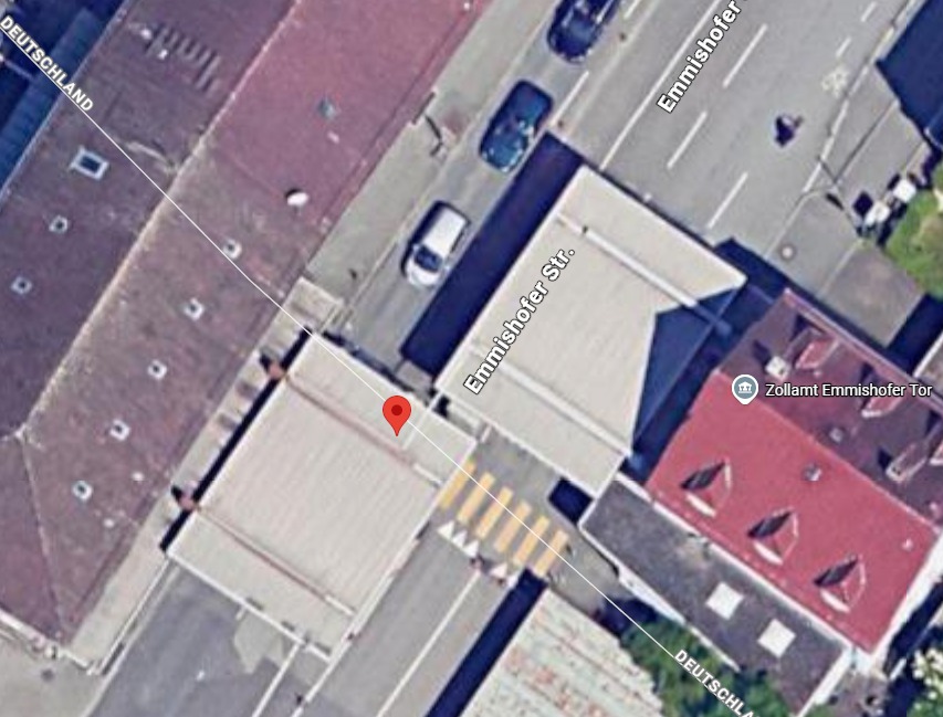
The incident report describes the point of contact as “at the Planton booth (Swiss sovereign territory)”. This geographical classification has been submitted for official verification.
DOCUMENTATION · BORDER INCIDENT 08.12.2022
A spatial reconstruction based on the BAZG incident report, the October 2026 photographic documentation and the still-pending official determination of the state border.
Official determination of the location still pendingThe presentation deliberately distinguishes between information contained in records, locations visible in photographs, Marijan Radosevic’s stated position and the legally authoritative determination of the state border.
The incident report describes the point of contact as “at the Planton booth (Swiss sovereign territory)”. This geographical classification has been submitted for official verification.
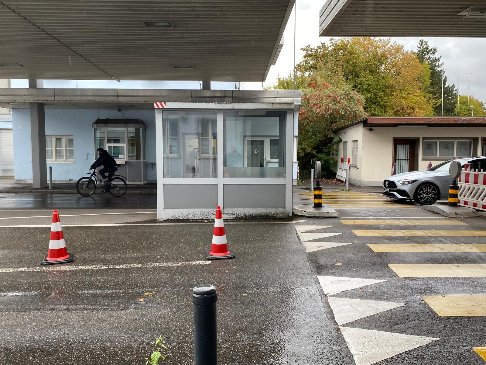
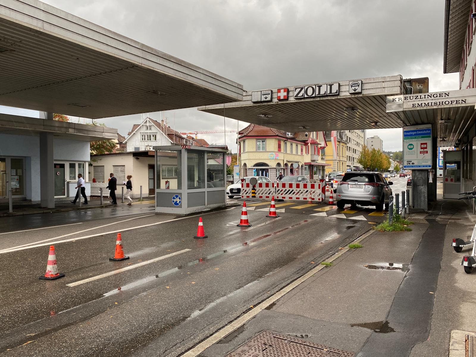
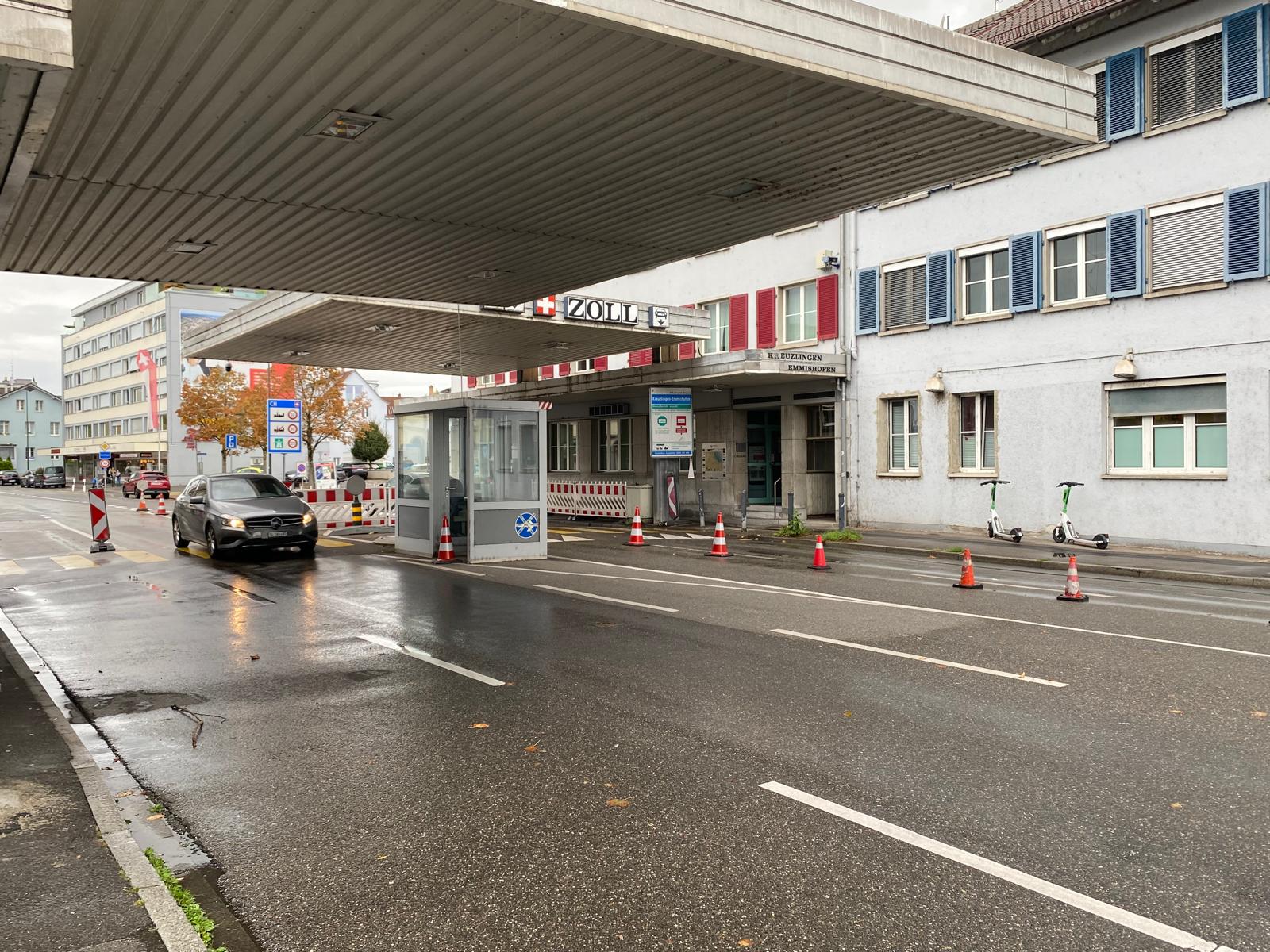
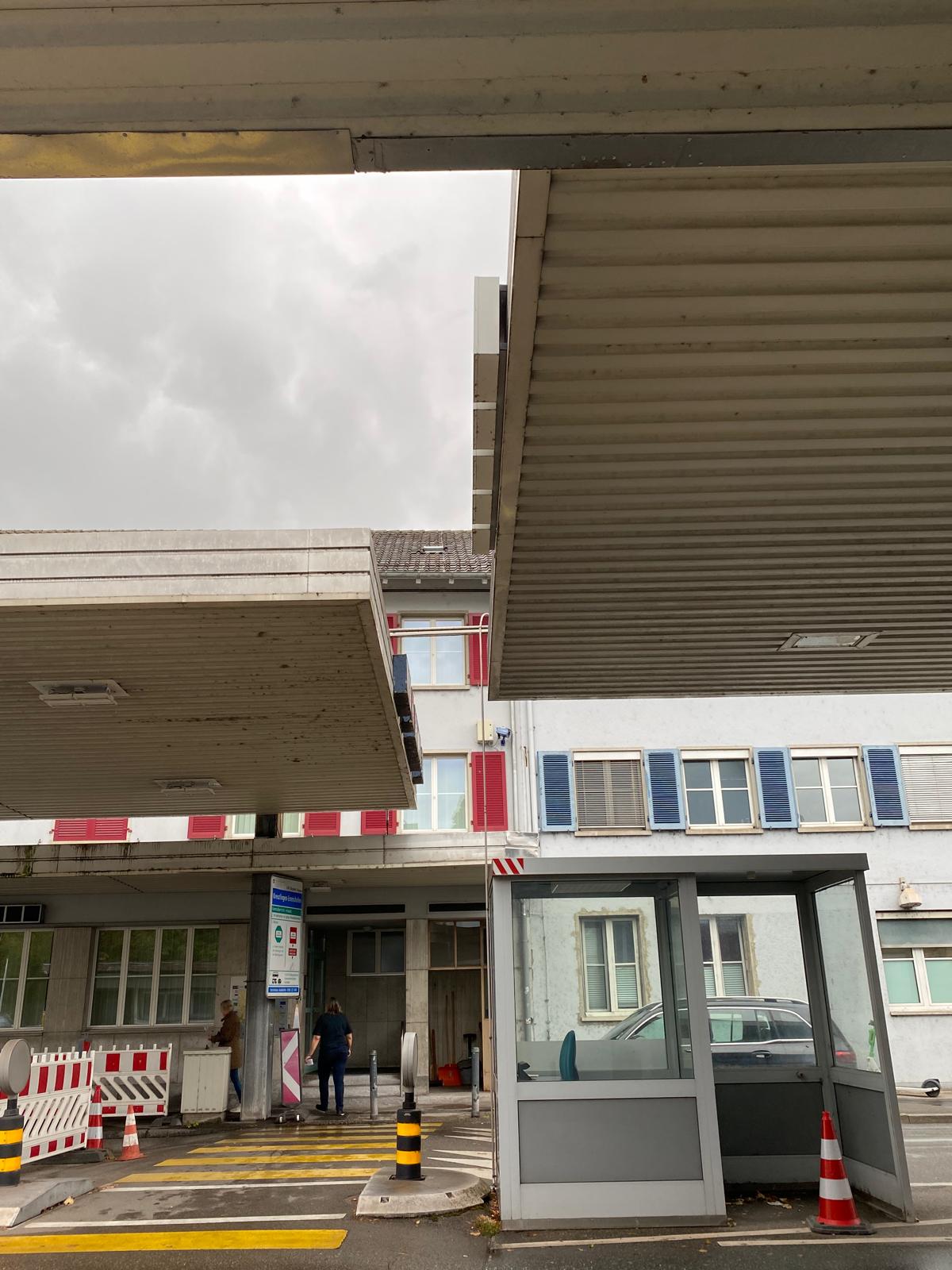
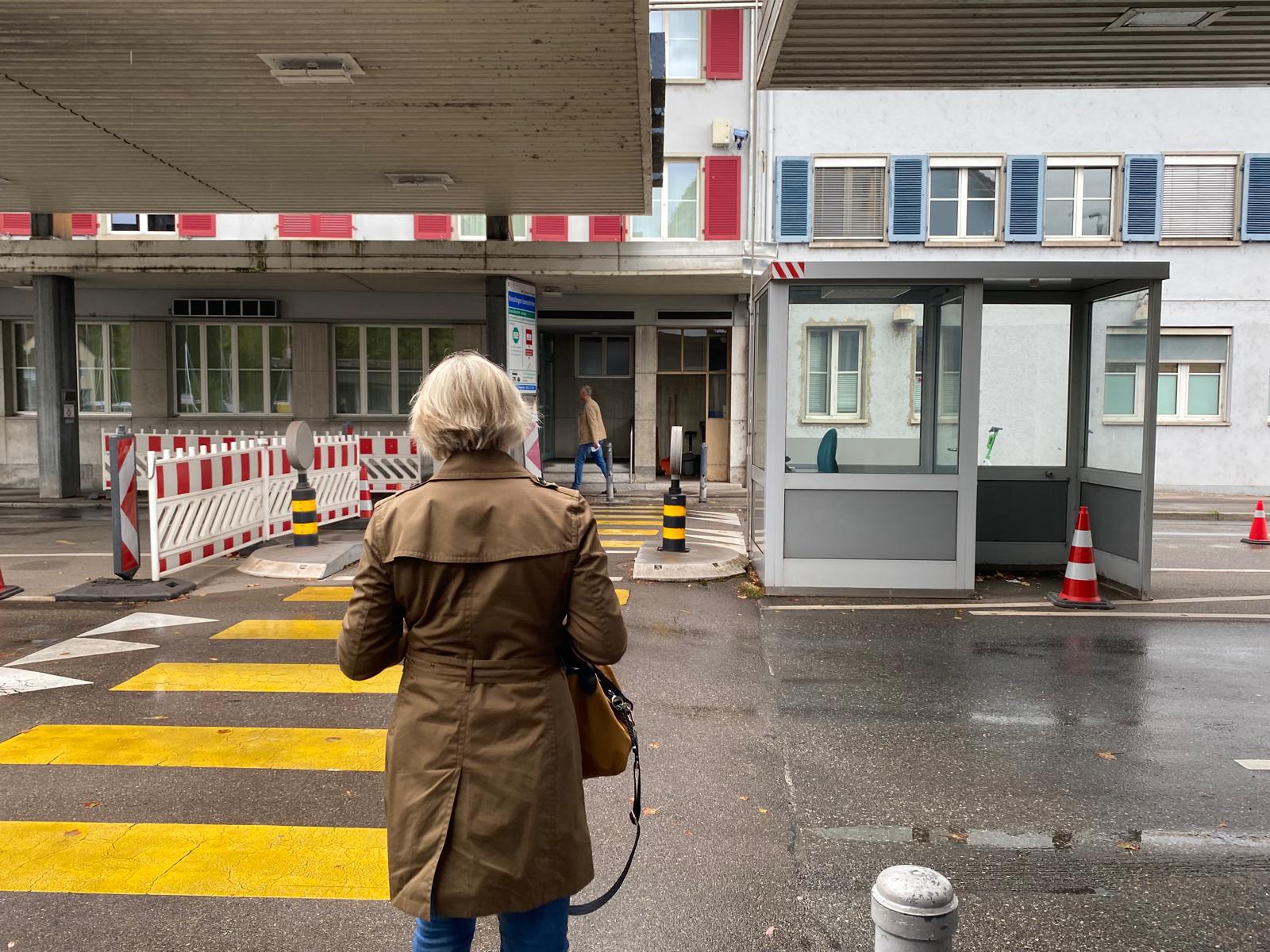
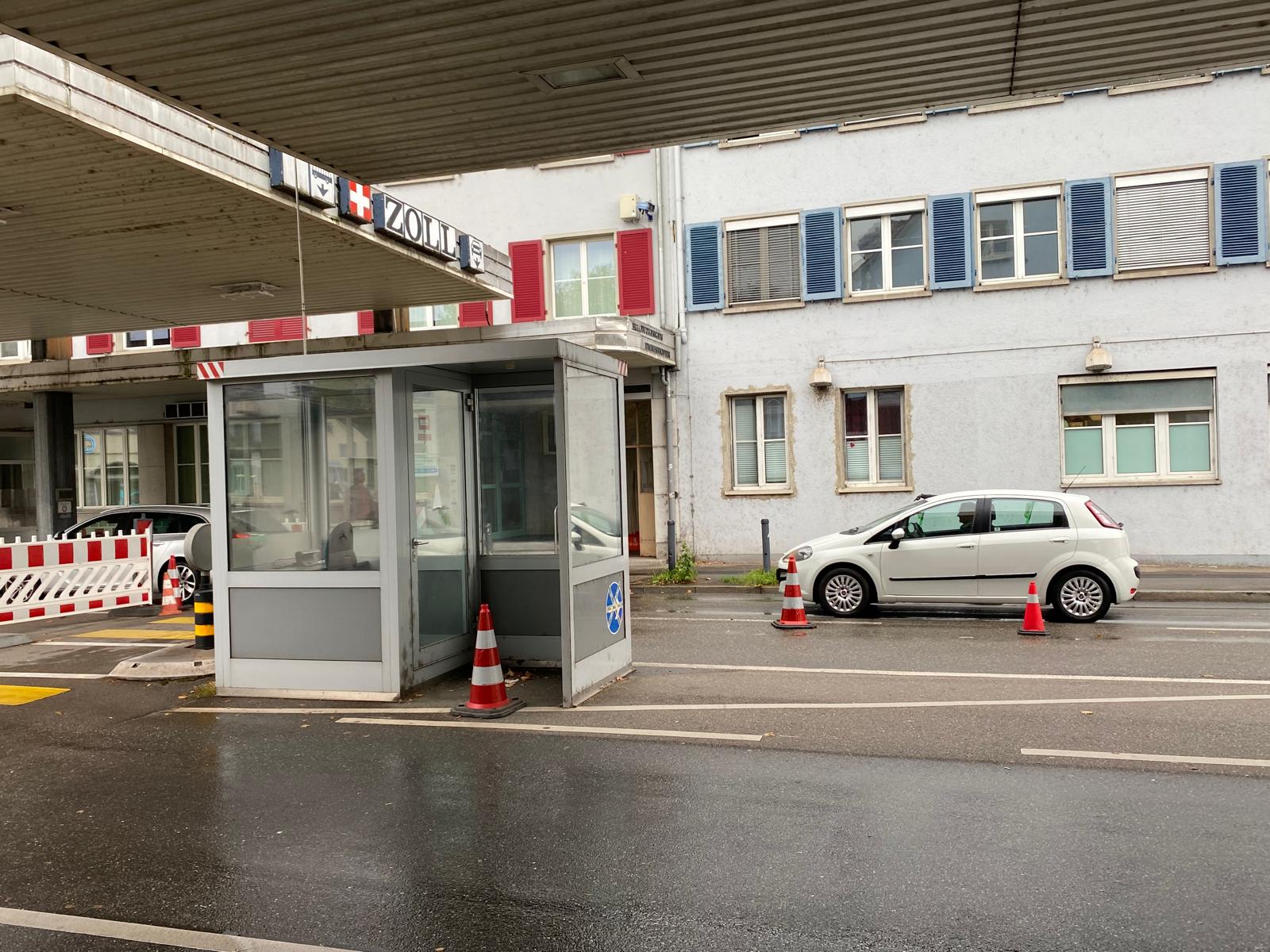
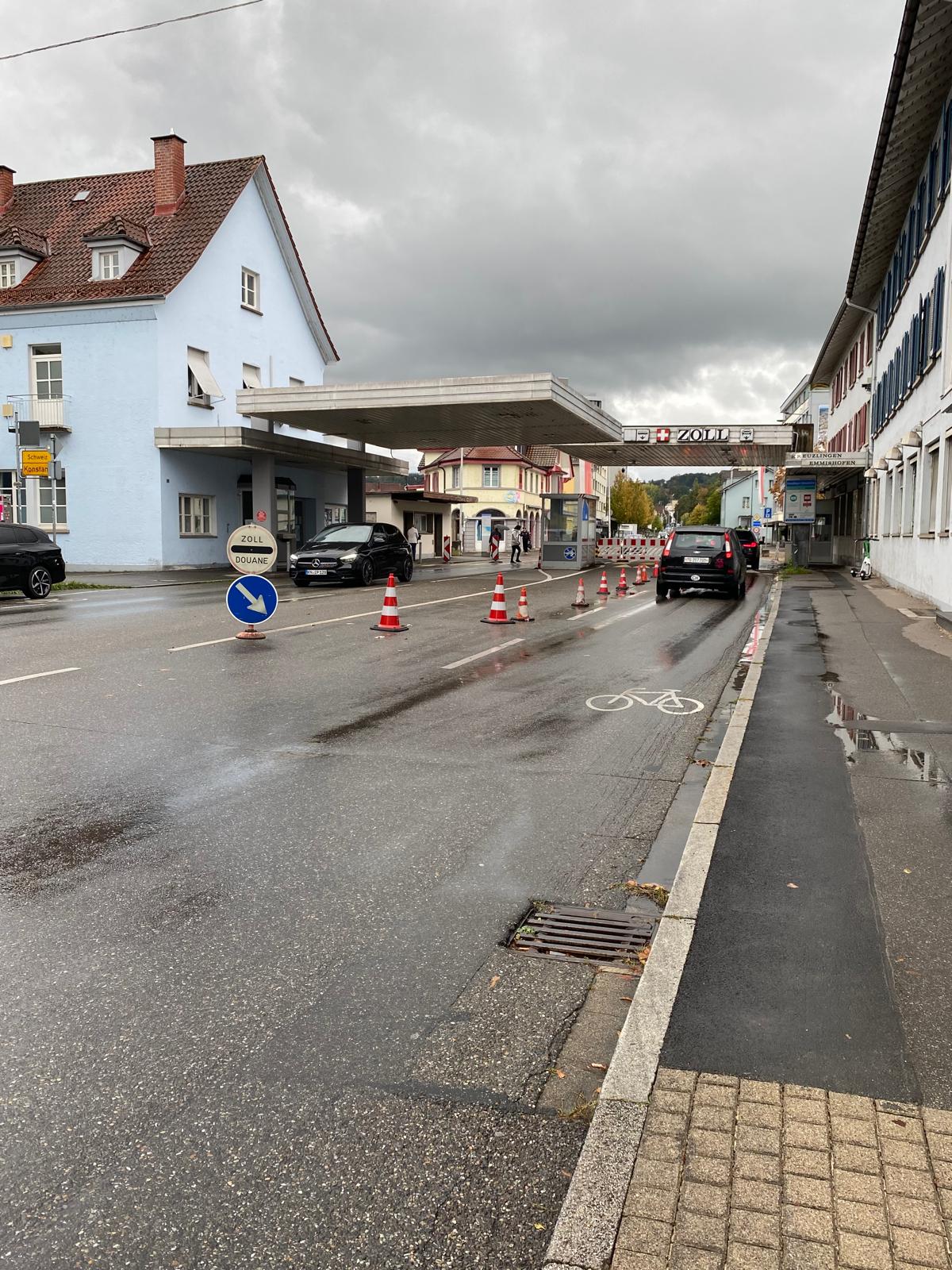
The photographs show the control booth, customs buildings, pedestrian route, first red-and-white traffic cone and the first doorway of the Swiss part of the building.
Marijan Radosevic states that during the material clarification he stood by the first red-and-white cone after the pedestrian crossing, level with the control booth.
The decisive question is on which sovereign territory this position lay when the first binding official instruction was given. This is to be established from official border, surveying and cadastral records.
Clarification at the border crossing, followed by an instruction to enter a room in the adjoining Swiss part of the building.
BAZG provided records relating to the incident, including an incident report containing a geographical classification of the location.
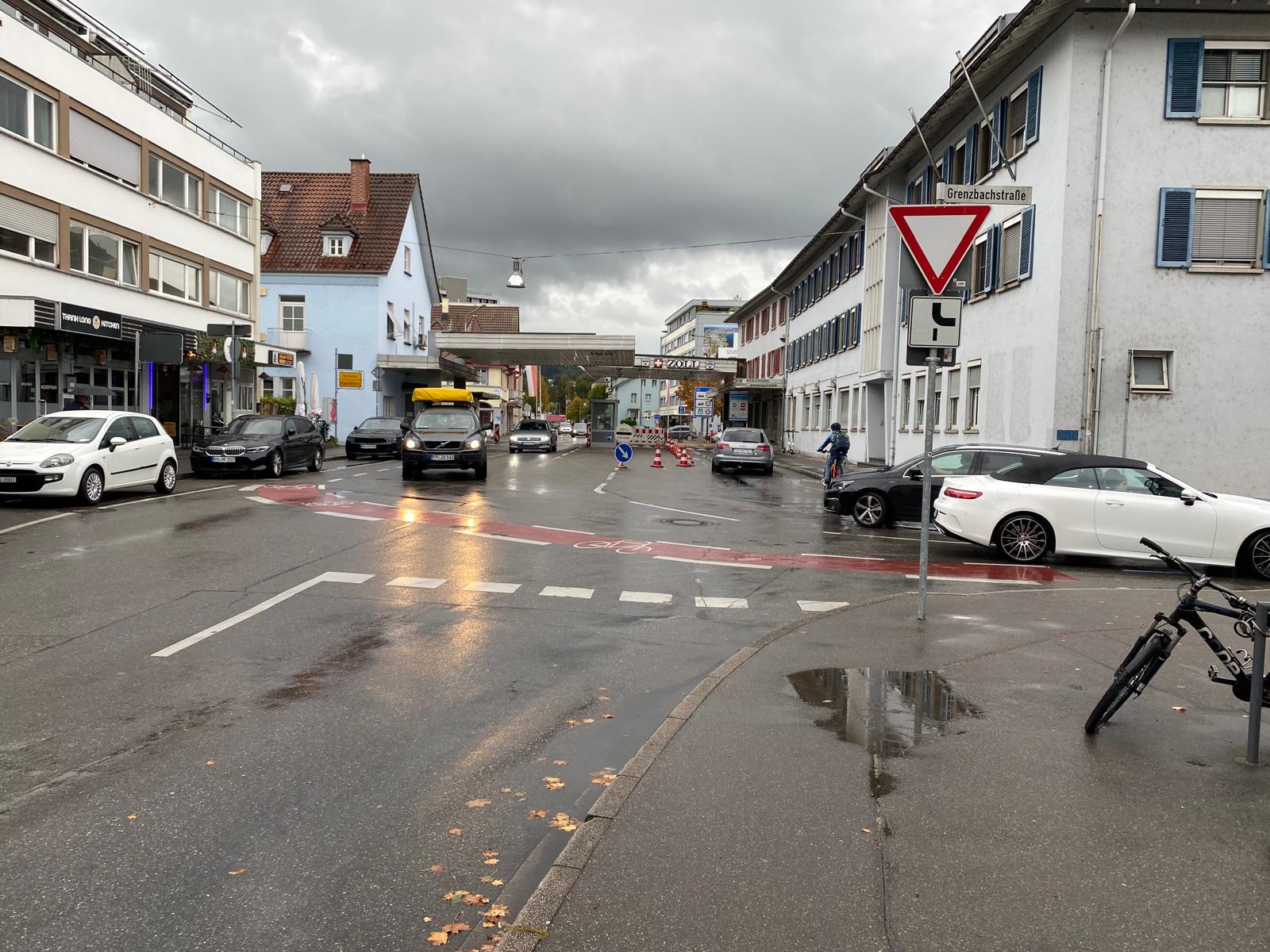
New photographs document the control booth, building division, pedestrian route and the stated position.
The prosecutor was asked to compare the stated position with official border, surveying and cadastral records and to provide the current procedural status.
The images make the route from the stated position to the first doorway of the Swiss part of the building understandable. They do not replace an official border survey.
First red-and-white cone after the pedestrian crossing, level with the control booth.
The booth is the central reference point of the reconstruction.
A vertical downpipe provides a visible reference between the building sections.
The room in the adjoining Swiss section was entered only after an instruction to do so.
Nine photographs document the present spatial situation. Click any image to open it at full size.
On which sovereign territory was the stated position located at the moment of the first binding official instruction?